
Plain and Simple Planes
What is flying over your head, right now.
Not on the App Store yet. This is a test build, and it installs through TestFlight — Apple’s own app for trying software before it is released, which you will need to install first. Places are limited, and a test build stops working after ninety days; the App Store version replaces it once Apple has approved it. It is the same app either way: free, no accounts, no advertising, and nothing collected.
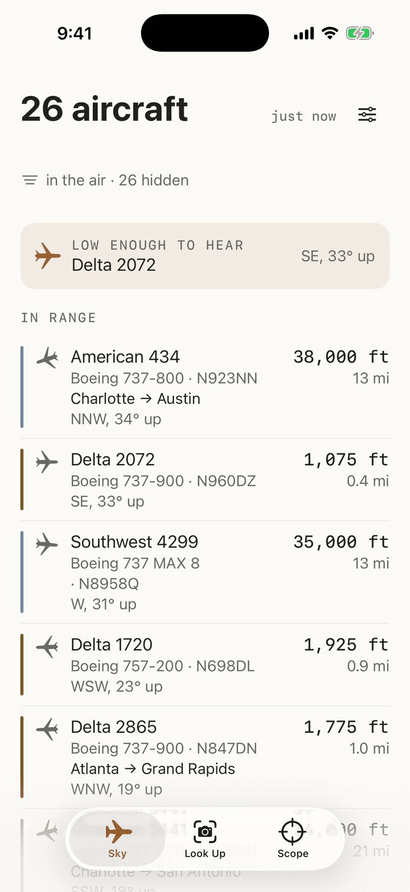
- What is over your head right now, sorted by whatever is nearly on top of you.
- Which way to look and how far up — with a real map when you want one, and where a flight is going when that answer is honest.
- A coordinate rounded to about a kilometre is everything that leaves your phone. Nobody stores it, including me.
Everything it does
Who this is for
For anyone who has looked up at an airplane and wondered what it is and where it is going. It needs an iPhone or iPad and nothing else, and it costs nothing.
It will suit you if you want an answer in one glance — what that one is, and which way to look — rather than a map you have to learn to read first. There is a map when you want one, and the list works on its own when you don't. It is built for standing in a garden, not for sitting at a desk.
It will not suit you if you want to track a particular flight, set an alert for one, or watch an airplane across a whole journey. None of that is here. It answers one question, about the sky you are standing under, at the moment you ask.
One thing to know before you download it: this is the only Plain and Simple app that needs the internet. Where aircraft are right now is not something a phone can know on its own.
How to set it up
- 01Download it from the App Store and open it. There is nothing to buy, no account to make, and nothing to sign in to.
- 02Allow it to see roughly where you are. It rounds your position to about a kilometre before it asks anything — enough to work out what is above you, and not enough to say which street you are on.
- 03Read the list. It is ordered by how close to straight up each aircraft is, so the one you can actually see is at the top, with the direction to look and how high it is.
- 04Point your phone at the sky on the Look Up tab if you would rather be shown than told. The camera is a viewfinder and nothing more — nothing is photographed, recorded, or kept.
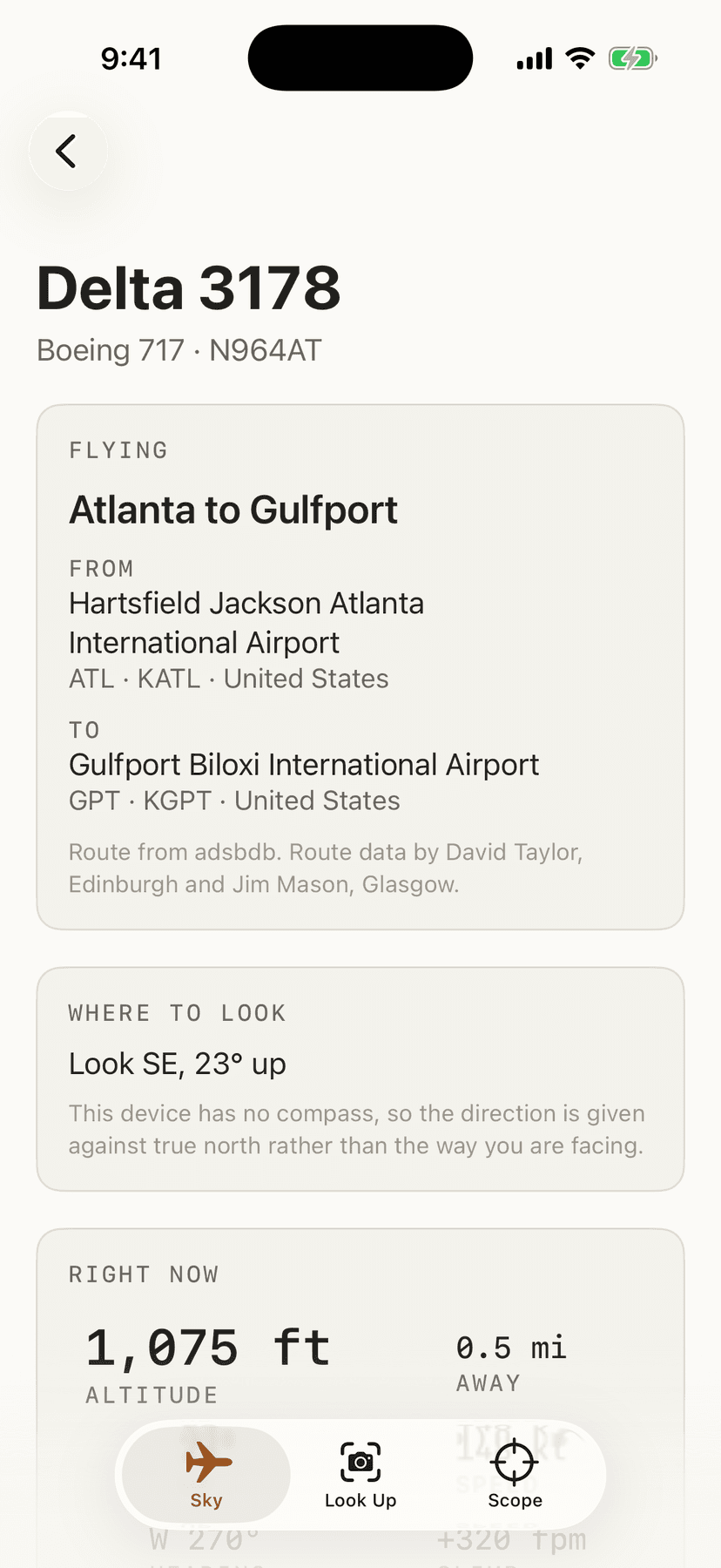
- 05Tap any aircraft for everything known about it: the type, the airline, its speed and heading, whether it is climbing, and — when it can be confirmed — where it is flying from and to.
What it does
- Sorted by what is nearly overhead
- It tells you what is flying above you, sorted by how nearly overhead each one is. That is not the same as sorting by distance, and the difference is the whole point: an airliner at 36,000 feet two miles away is nearly straight up, and a helicopter at 800 feet two miles away is barely above the rooftops.
- Which way to look, and how far up
- Every aircraft comes with the direction to look and how far up, in plain words — “look west-north-west, 41° up”. On an iPhone the arrow turns with you; on a device with no compass it gives you the direction against north instead, and says which it is doing rather than quietly guessing.
- Three ways of seeing the same sky
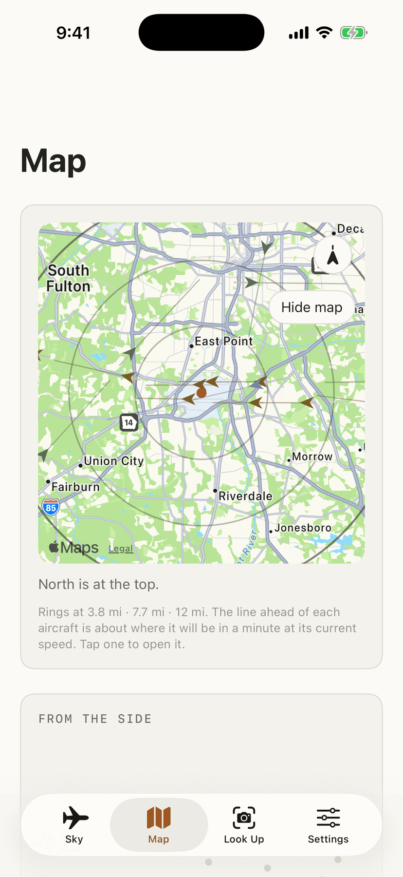
- Three ways of seeing the same sky. Sky is the list, and it is the one that always works. Map puts the aircraft around you, with a view from the side underneath so the shape of the traffic is visible — the column descending towards a nearby airport, and the flat band of everything just passing over. Look Up puts a viewfinder on top and shows what is in front of you. The map keeps north at the top, or turns with you if you would rather; on a device with no compass it says so instead of pretending. Tap any aircraft on any of the drawings to open it.
- A real map, only if you want one
- The Map draws range rings and the aircraft on them, and needs nothing from anybody. If you would rather see the actual ground underneath — roads, rivers, the airport — you can turn on Apple's map, which is built into your phone. It is off until you switch it on, and before it comes on the app explains what changes: Apple's map service sends those pictures to your phone and sees roughly which area you are looking at. That is Apple. Plain and Simple still runs no servers, still has no account, and still receives nothing about you either way.
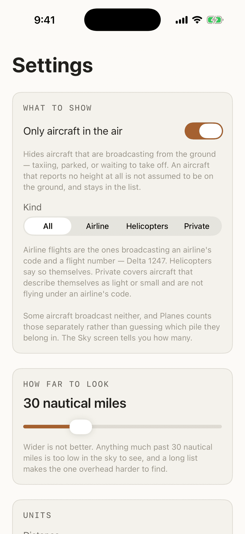
- Filters that say what they are hiding
- Filters for the sky you actually want: only aircraft in the air, or only airline flights, helicopters, or private and light aircraft. When a filter is on, the screen says so and tells you how many it is hiding — and it counts the aircraft it could not identify separately, rather than guessing which pile they belong in.
- Where a flight is going, when that is honest
- Where a flight is going, when that can be shown honestly. The route database is keyed by flight number, and flight numbers get reused — the same number often flies the return leg an hour later, and a different city pair next season. So every route is checked against the aircraft's own position and climb before it appears, and one that cannot be confirmed is not shown at all. The app would rather say nothing than tell you your airplane is going to Austin when it is going to Boston.
- Half an answer, labeled as half
- When only half of that can be proved, you get half. An airplane climbing steeply a few miles from an airport has just left it — that is not a lookup, it is something the aircraft itself is broadcasting — so the app will say “departed Atlanta” and tell you straight out that where it is heading is not confirmed. It is the only way a small private aircraft, which files no route anywhere, ever gets a line at all. Where two airports sit close enough together to be confused, it says nothing rather than pick one.
- The reference data ships with the app
- The names of airlines, aircraft types and countries are built into the app and are never downloaded, and so is a list of the world's airports. Nothing about the sky is guessed at either: an aircraft that reports no height shows a dash rather than a zero, and an empty list says whether the sky was quiet or the question could not be asked. Those are different things and the app never lets them look the same.
- A widget that admits it is not live
- A home screen widget showing the one nearest to overhead, with the time it was found — because a widget cannot be live, and this one says so instead of pretending.
- What leaves your phone
- What leaves your phone is a coordinate rounded to about a kilometre, and nothing else. No account, no name, no device or advertising identifier, no analytics, no tracking, and nothing to buy. It goes straight to the volunteer network that answers the question, not through any server of mine — there isn't one. Nobody stores it, including me.
- Where the positions come from
- Aircraft positions come from adsb.lol, a network of volunteers running receivers in their homes, published under the Open Database License. That means coverage is what volunteers can hear, not everything in the sky: low and small aircraft are often missed, and coverage thins away from cities. The app says “nothing we can see” and never “nothing is up there”.